Mapmaking in Early America
Opening October 17, 2026
Will be on view in the Michael L. and Carolyn C. McNamara Gallery
This exhibition has been generously funded by Michael L. and Carolyn C. McNamara.
In a time before advanced technologies like GPS and satellites, how were detailed maps created in the 18th century? This exhibition will explore the evolution of map production in early America from the 17th to the early 19th centuries from surveyors and chain-carriers who walked the land to engravers and printers who created the maps to merchants who sold them. Highlights include maps produced in North America – rare before the early 19th century – including a survey by a 19-year-old George Washington. Also on view will be tools used by surveyors as they mapped the land.
Into the mid-18th century, maps of the British North American colonies were surveyed in the colonies and then sent to England for publishing. A section of the exhibition focuses on the technical skills of the engraving process in England and how the English map trade functioned. Eventually, maps were surveyed, compiled, engraved, printed, and published in the Americas often motivated by land disputes, war, and trade.
As a new nation, Americans had a need for maps. Individual states underwent surveying and mapping projects that sought to define the lands now included in the nation’s boundaries. These maps served a variety of purposes, such as infrastructure development, national memory, and geographic education and literacy.
Explore Pieces from the Exhibition
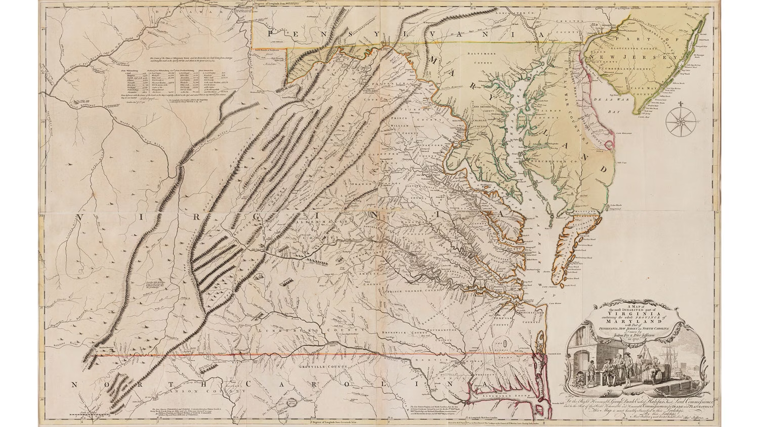
A MAP of the most INHABITED part of VIRGINIA, Joshua Fry and Peter Jefferson, cartographers; Thomas Jefferys, engraver and publisher, London, England, 1768, line engraving on laid paper with hand-coloring. Museum purchase, 1968-11
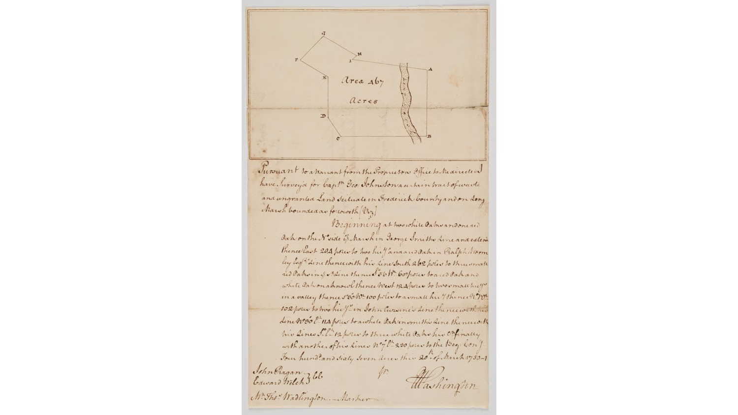
Pursuant to a warrant ....I have Survey'd for Captn Geo: Johnston a certain tract of waste and ungranted Land scituate in Frederick County and on Long Marsh, George Washington, surveyor, Jefferson County, West Virginia, 1751, ink on laid paper. Gift of Mr. and Mrs. Richard F. Barry III, Mr. and Mrs. Macon F. Brock, Mr. and Mrs. David R. Goode, Mr. and Mrs. Conrad M. Hall, Mr. and Mrs. Thomas G. Johnson Jr., Mr. and Mrs. Charles W. Moorman IV, and Mr. and Mrs. Richard D. Roberts, 2017-221

Map No. II (Map of New Jersey and New York), Lewis Evans, compiler; James Alexander, cartographer; James Turner, engraver, Boston, Massachusetts,1747, line engraving on laid paper. Museum Purchase, 2019-88
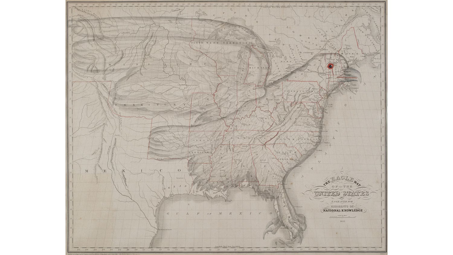
The Eagle Map of the United States, Joseph Churchman and James Churchman, compilers, Philadelphia, Pennsylvania, 1833, line engraving with hand color mounted on modern linen. Museum Purchase, 2021-189
Delve into our Exhibitions Online
Explore our Online Collections to learn more about The Colonial Williamsburg Foundation's vast collections of fine, decorative, mechanical, and folk art.